
The map refresh before Christmas last year left a few things outstanding that have been dealt with in this weekend’s update.
There were 72 settlements that were outstanding for verification in the Samara province that have been confirmed and fully documented. These were mostly established in the Soviet era. Because I was in the neighborhood, an additional 42 settlements were added as I went through the Stumpp map by section. Many of them were chutors/khutors, collectives and state farms; some only appeared by name on one map other than Stumpp’s.
The imperial Samara province was dissolved in 1928, so all those settlements with populations recorded in the 1924 census are recorded with their imperial district/province. Anything established after 1928 do not have the district and the province is asterisked to note that’s for categorizing these settlements together with those in what is the former Samara province at that point.
I did have difficulty confirming some settlements as part of the “Volga German enclave” because they appeared during the interwar years (1918-1939). I hesitate to make the assumption that because they were near other Volga colonies that they were indeed “Volga German.” I did my best to not assume, but rather, try to find a source or a site that was researching them as Volga German settlement. Therefore, if you are looking for places where Volga Germans lived during the interwar period, you are strongly encouraged to use the Samara and Saratov province maps or the regional map instead of just the Volga enclave map. As always, if you don’t find what you’re looking for, let me know, and I will try to find it for you.
The “About” pin has been updated to include the Black Sea German Research (BSGR) website. Germans from the provinces of South Russia migrated north to the Orenburg and Ufa provinces, and there are some recent Catholic church record translations available at BSGR for the Chelyabinsk and Orenburg parishes. They also have EWZ indexes in their database with hundreds entries from both EWZs and donated GEDCOMs that refer to settlements in the provinces in this region. BSGR is a real sleeper site of information. Spend 3 minutes searching the database and the website for things you are sure are not there, and prepare to be pleasantly surprised.
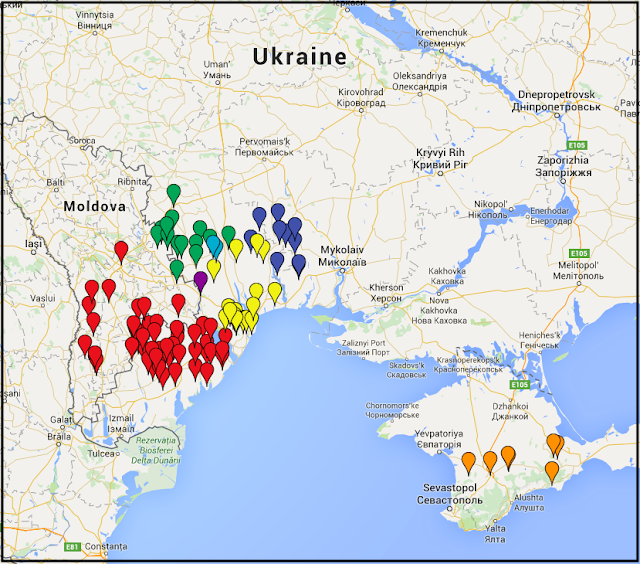
In December during my annual clean-up-my-downloads-folder event, I posted on social media about 14 German chutors in Tsarev District, Astrakhan Province...later the Stalingrad Oblast after the imperial province was dissolved, today in the Volgograd Oblast. Someone’s grandmother was born there was able to confirm that the German origins were linked to Dobrinka and Galka. I like when things like that happen, when the story behind a pin is suddenly revealed. Those settlements have been updated with that information.
Last updated 11 February 2023