 |
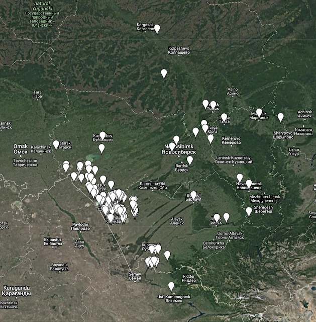
| 1914 map of the Tobolsk Province from the David Rumsey Map Collection |
The splitting of Asiatic Russia into its former imperial provinces continues. The former Tobolsk Province in Western Siberia is now complete. This province shrunk over time. I recorded it with its boundaries in 1914, toward the end of the imperial period and when the voluntary resettlement of German and other colonists from elsewhere in Russia to Siberia was in full swing. It spans parts of the present-day Omsk, Tyumen, Sverdlovsk, and Kurgan oblasts. Thirty-eight more settlements have been added in the process. And again, like with Tomsk, settlement was primarily in the southern part of the province with a mix of previous regions of origin (Volga, Black Sea, Volhynia) and religious confessions (heavily Mennonite, Protestant, very few Catholics). More mixed ethnicity settlements, too, Russian, Ukrainian, German, Estonian, Latvian.
The Imperial Census of 1897, there were 1,433,043 inhabitants in Tobolsk Province. Of those, 1,120 (0.08%) reported themselves as native German speakers. This increased as resettlement proceeded over the next several years.
With this province, Siberia, as it was defined administratively, is complete.
Next up will be the Steppes Krai and the former oblasts of Akmolinsk, Semipalatinsk, Turgay, and Ural. Starting with Akmolinsk, this will cover the remainder of the present-day Omsk Oblast in Russia and most of northern Kazakhstan. This was a heavier area of resettlement by Germans with nearly 5,000 Germans living in the region before 1897.
As has been mentioned before, the update map data will be posted at the end of this research exercise all at once. Now that it’s beginning to take shape, I’m looking forward to seeing how it will look at the end.
# # #


